Upper East Region · Paga Nania · Three kilometres from the ponds
Visiting Pikworo
A rock field with no buildings, no signs and nothing to look at — until someone shows you. This page is about how to actually go: what it costs, how long it takes, what the guide will tell you, and how to be there without being a tourist about it. It is three kilometres from the crocodile pond and receives a fraction of the visitors.
Before you go
Pikworo was a holding and auction site. People taken in raids across the north and from what is now Burkina Faso were kept here — accounts give an average of around two hundred at a time — before being marched roughly 150 kilometres south to the market at Salaga, sold again, and moved on toward the coast and the ships.
There is no dungeon, no wall, no cannon, no fort. That is the first thing to understand, because visitors arriving from Cape Coast or Elmina often expect something comparable and are briefly disorientated when they get out of the car and see scrub and boulders.
What is actually on the ground
Granite outcrops with bowls hollowed into their flat tops — cut by the people held here, and used as plates. A split in the rock that holds water. A raised stone where punishment was carried out. Boulders that ring when struck. Graves. A lookout.
Why it works anyway
Because nothing has been built over it. At the coastal castles you are inside a structure that has been whitewashed, restored, interpreted and photographed for two centuries. At Pikworo you are standing on the ground with the marks still in it, and a guide is telling you what each one is. Many visitors find it considerably harder than the castles.
You cannot do this alone
There is minimal interpretive signage. Without a guide it is a rock field and you will leave in ten minutes having understood nothing. The guides are local, and their fee and tips are effectively the site's income.
Allow an hour, and then some
The tour itself runs around an hour. Most people want to sit for a while afterwards. Build that in rather than scheduling straight into the next thing.
Getting there
Pikworo is at Paga Nania, roughly three kilometres west of Paga, in the Kassena Nankana West District. Not two hours — three kilometres. We published the wrong figure ourselves on an older page and have corrected it, but the error circulates widely enough that it is worth being emphatic.
From Paga town
A few minutes by taxi or motorbike from the crocodile ponds. Arrange the return at the same time as the outward, because there is nothing waiting at the site and no reason for a vehicle to pass.
From Bolgatanga
The practical base for the whole area. Trotros and shared taxis run north to Paga through the day, then the short hop west. Draw your cash in Bolga.
From Tamale
Around four hours by road. Tamale has scheduled flights from Accra, which makes flying the long leg and hiring locally far more sensible than driving the length of the country. See our public transport page.
The approach road
Unsealed for the last stretch and rougher after rain. Nothing dramatic, but a low-clearance car in the wet season may struggle. Nobody grits this road.
- Cash only. No card facility, no ATM nearby. Bring small notes.
- Fees are set locally and change. Expect separate rates for Ghanaians and non-Ghanaians, and a charge for cameras. We do not publish figures because they go stale — ask on arrival.
- Budget the guide's tip separately from the entrance fee and hand it over directly.
- Early or late. There is almost no shade on the rock field and the Upper East in the middle of the day is punishing. Morning is better for light and for standing still.
- Carry water and sun cover. Nothing is sold on site.
What you will be shown
The tour moves between the outcrops. Roughly in this order, though guides vary.
-
The eating bowls
Shallow scoops hollowed into the flat tops of the boulders, in clusters, dozens of them. Cut by the captives themselves. The size of each bowl indicates how many people ate from it. You can put your hand in one, and most people do. -
The water source
A split in one of the largest rocks that holds water — reliable water in a region where water is not reliable. This is the reason the site exists in this spot rather than anywhere else. -
The punishment rock
A raised stone where those who tried to escape or disobeyed were held, exposed to the sun without food or water, while others were made to watch. The precise accounts vary between guides — see below. -
The ringing rocks
Certain boulders sound when struck, at different pitches. Guides describe them as having been used for drumming in the evenings. What that meant to the people doing it is a question the site leaves open, and should. -
The cemetery
Graves of those who died here. Locally these dead are not treated as belonging to the past — the belief in this area is that souls who died in this manner remain unsettled and require rites. Ask before photographing, and accept a no. -
The lookout
The highest outcrop, used as a watch point — not against escape, but against rival raiders coming to seize the captives. That tells you exactly what the people held here represented to everyone in the landscape.
Where the accounts differ, and why we say so
Pikworo's history is carried orally by its guides. That is a strength — it is why the site is legible at all — and it means details differ between tellings. We think you should know which parts are firm and which are interpretation, because a great deal of published writing about this site presents all of it with equal confidence.
The bowls
Some guides say they were cut by all the captives as a matter of course. Others say they were cut as punishment by those who attempted escape. Both versions circulate. Nobody knows.
The punishment rock
Chained in the sun; made to kneel and follow the sun with their eyes until blinded; a third offence meaning execution; beaten as well as exposed. Different guides, different details. The rock is real and its use is not in doubt. The specifics are not fixed.
The ringing rocks
You will sometimes read that these formed a natural amphitheatre where guards forced captives to perform for entertainment. That is one reading, and it is stated as fact far more often than the evidence supports. Guides at the site tell it differently. Treat it as an interpretation.
The dates
You will see 1704 to 1845 everywhere, always in that form, never with a source attached. It has been copied forward rather than established. It may be broadly right. It is received tradition, not documented record, and we set out why on the full page.
None of this is a reason to doubt the site or to second-guess the guides. The bowls are cut into the rock. The graves are there. The water is there. Nobody argues about whether people were held at Pikworo and marched south. Ask questions rather than assuming the first version is definitive — and be careful about which version you repeat afterwards.
How to be there
There is no correct emotional response to Pikworo and nobody is grading you. But a few practical things make the difference between visiting well and visiting badly.
- Do not treat it as a photo stop between the crocodiles and lunch. If your schedule only allows twenty minutes, it is genuinely better to skip it and come back another day.
- Ask before photographing the graves, and accept a refusal without negotiating. The same goes for anything that looks like a shrine or an offering.
- Some rocks have been painted by visitors. Opinion locally is divided on whether that humanises the site or defaces it. Whatever you think, do not add to it.
- Let the guide set the pace. They know where the tour needs silence. Filling those gaps with questions is the most common way visitors get this wrong.
- Ask about the present, not only the past. Who maintains the site, what the community gets from it, what has been promised and not delivered. The guides have views, and they are worth more than another question about dates.
- Think about children in advance. Guides will pitch the account to your group, but the subject matter does not change. Decide before you arrive.
- Pay properly. This is one of the most significant heritage sites in Ghana and it is running on entrance fees and tips. Haggling here is not a good look.
Doing this with the crocodile ponds
Most people do both on the same morning, because they are three kilometres apart. The order matters more than you would think.
Pikworo first, ponds second. Two reasons. Pikworo is better in the cool of the early morning and there is no shade on it. And doing it in that order means you finish the morning at the water rather than beginning your day with the punishment rock and then being asked to smile beside a crocodile.
The proximity is worth sitting with for a moment. Coaches come to Paga for the crocodiles. Three kilometres west, the site where captives were held before the march south gets a fraction of the same traffic. Ghana's own tourism officials have argued that PANAFEST should begin at Pikworo rather than on the coast, on the grounds that this is where the story starts. It has not translated into visitors, funding or a sealed road.
Going to both, in that order, and paying properly at each, is a small thing. It is also about the only thing a visitor can actually do about it.
Afterwards: the rest of the route
Pikworo is the first link in a chain, and it makes far more sense as part of a sequence than as a stop.
- Salaga — roughly 150 kilometres south, and the market where the people held here were sold on. The next link, and the walk they actually made.
- Sandema and the Feok festival — Builsa country, where the resistance to the raiders is commemorated every December. The other side of the same history.
- Gwollu and Nalerigu defence walls — earth walls built by communities to keep raiders out. What people did when they could not be protected by anyone else.
- Assin Manso — the last wash before the coast, far to the south.
- The inland slave routes — the roads themselves, and who walked them.
- Why the roots lead inland — the coast was the exit, not the origin.
Run north to south and the sequence is the one people walked. Almost every heritage itinerary sold to visitors runs it backwards, starting at a castle, which is a bit like reading the last chapter first.
Connected reading
- Pikworo Slave Camp in full — the chain south, who was selling, and what is documented versus what is site tradition.
- Salaga Slave Market — 150 kilometres south, the next link.
- Assin Manso — the last wash before the coast.
- The Inland Slave Routes of Ghana — the roads from the north to the sea.
- Why the roots lead inland — the argument, with the evidence set out.
- The Kassena, and the Crocodiles — the people of this landscape, and why "Gurunsi" was Babatu's word.
- The Paga Crocodile Ponds — three kilometres east, and the other reason people come.
- Beyond the Pond — everything within reach, sorted by distance.
- Paga — the town in a day.
- Public Transport in Ghana — flights, coaches and getting north sensibly.
Practical details last verified . Pikworo is approximately three kilometres from the Paga crocodile ponds at Paga Nania; a figure of two hours published on an earlier version of our own pages was incorrect and has been corrected. The commonly cited operating dates of 1704 to 1845 appear across published sources without attribution to a primary record and are treated here as received tradition. Descriptions of the bowls, punishment rock, ringing rocks, cemetery and lookout are drawn from published guide accounts and visitor records, which differ in detail; those differences are set out rather than resolved. Fees, guide arrangements and road conditions change — confirm locally before travelling. All photography © Remo Kurka. Usage strictly by prior authorisation only.
In the quiet village of Nania, just a few kilometers west of Paga in Ghana’s Upper East Region, lies a place where the earth still remembers. The Pikworo Slave Camp, carved into the rocky savannah, is not just a historical site — it is a memorial of endurance, a wound in stone, and a testament to the resilience of the human spirit.
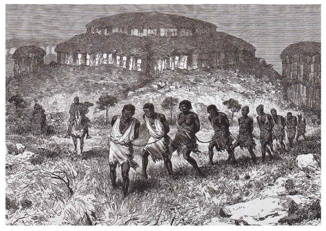
To Be Sold. A bitter truth for Diaspora Afro-Americans: Their roots are most likely in the North of today Ghana, Ivory Coast, Benin, Togo. Also of today Niger, Burkina Faso, Mali, and Central Africa.